MapView - Map Viewing Software
KAS Software MapView, to give it its full name, is an easy-to-use Windows multi-format map display program with 3-D viewing and GPS interfacing capability.
MapView has the following features:
- Display of multiple digital raster map formats, such as: geotiff, dem and our own gdf format maps.
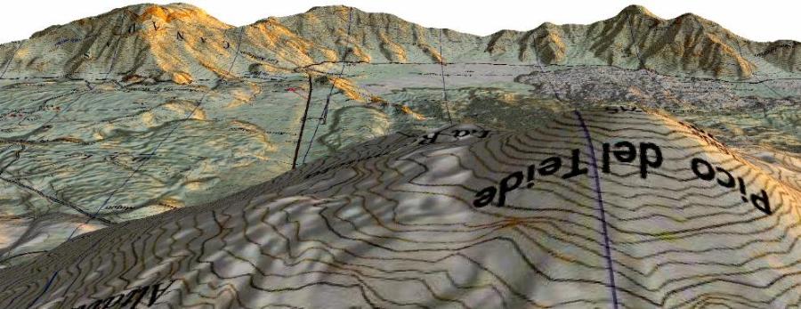
- 3-D map display using openGL, with the option of viewing a static model that can be rotated and zoomed, or a 'free-flying' mode. (How good this looks depends entirely upon the capabilities of your graphics card.)
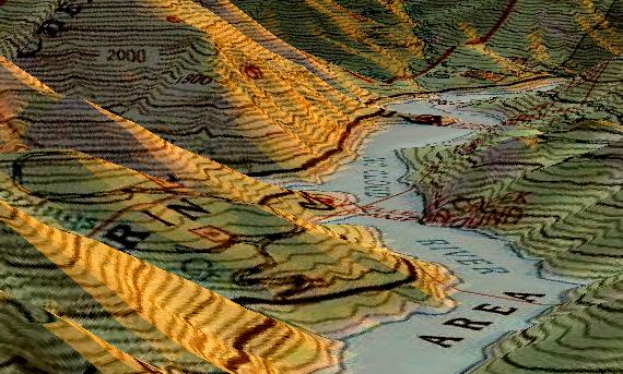
- 3-D map display using directX9. This requires maps produced by KAS Software, and which are in a special format derived from the open source StreamingCDLOD. With the right graphics card these maps have an impressive fly-thru capability.
- Hill shading to emphasise topography.
- Full printed output capability.
- GPS connectivity - download and upload current position, routes, tracks and waypoints to/from a range of handheld GPS devices, over both serial and USB links.
- Creation, editing and saving of routes, tracks and waypoints.
- GPX support - full reading and writing capabilities using this standard for geographical information interchange (such as routes, tracks & waypoints).
- Shapefile support - read, display & write support.
- Fully integrated searchable gazetteer.
Additional maps are available for purchase; these are composites of freely available data from various sources, which are processed then saved in KAS Software's open gdf format. Have a look at our OS OpenData™ derived maps and also our USGS geotiff derived maps.
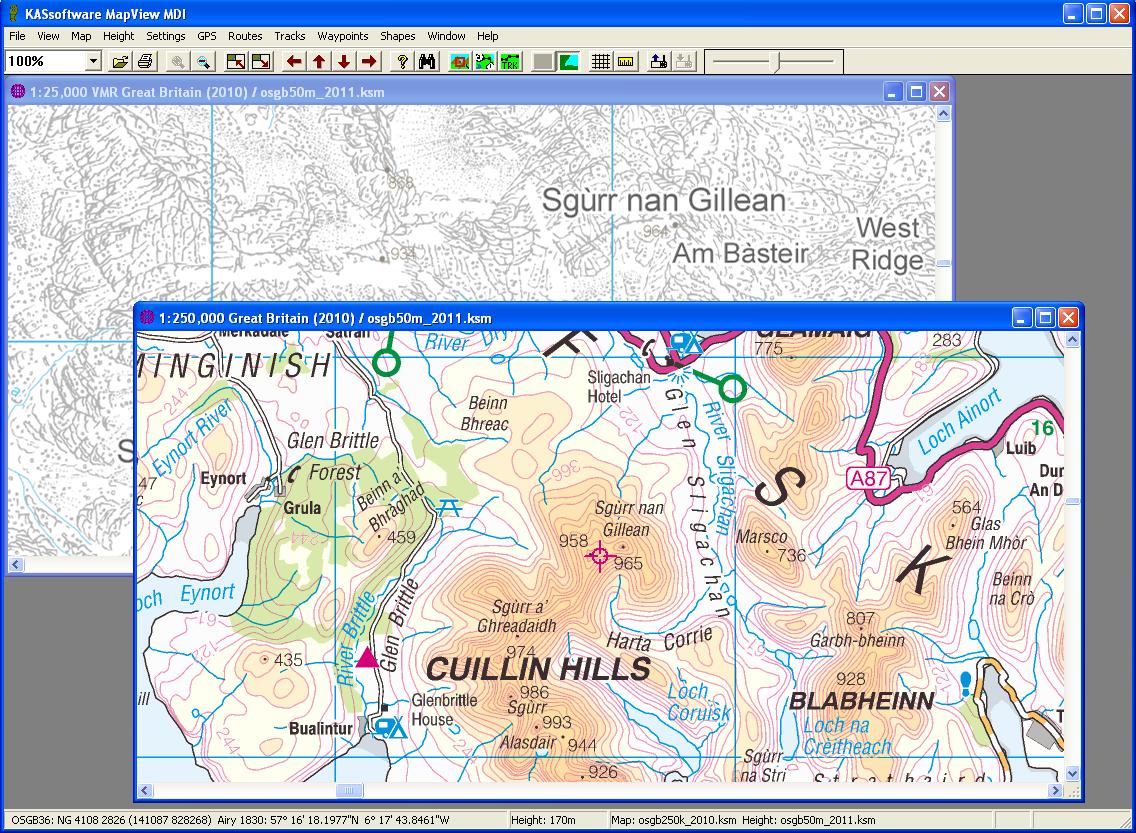
Hill Shading
The hill shading algorithm used is fairly rudimentary but really quite effective provided there are no more than five map pixels to every one elevation data pixel. e.g. With the free KAS Software OSGB OpenData™-derived OS Terrain 50m height data file, OSGB maps at a scale of 1:100,00 or numerically higher can show decent height shading, maps at a numerically lower scale will shade in a progressively blockier, less convincing, style.
Shading is applied to south and east facing slopes only, with darkness proportional to slope steepness.
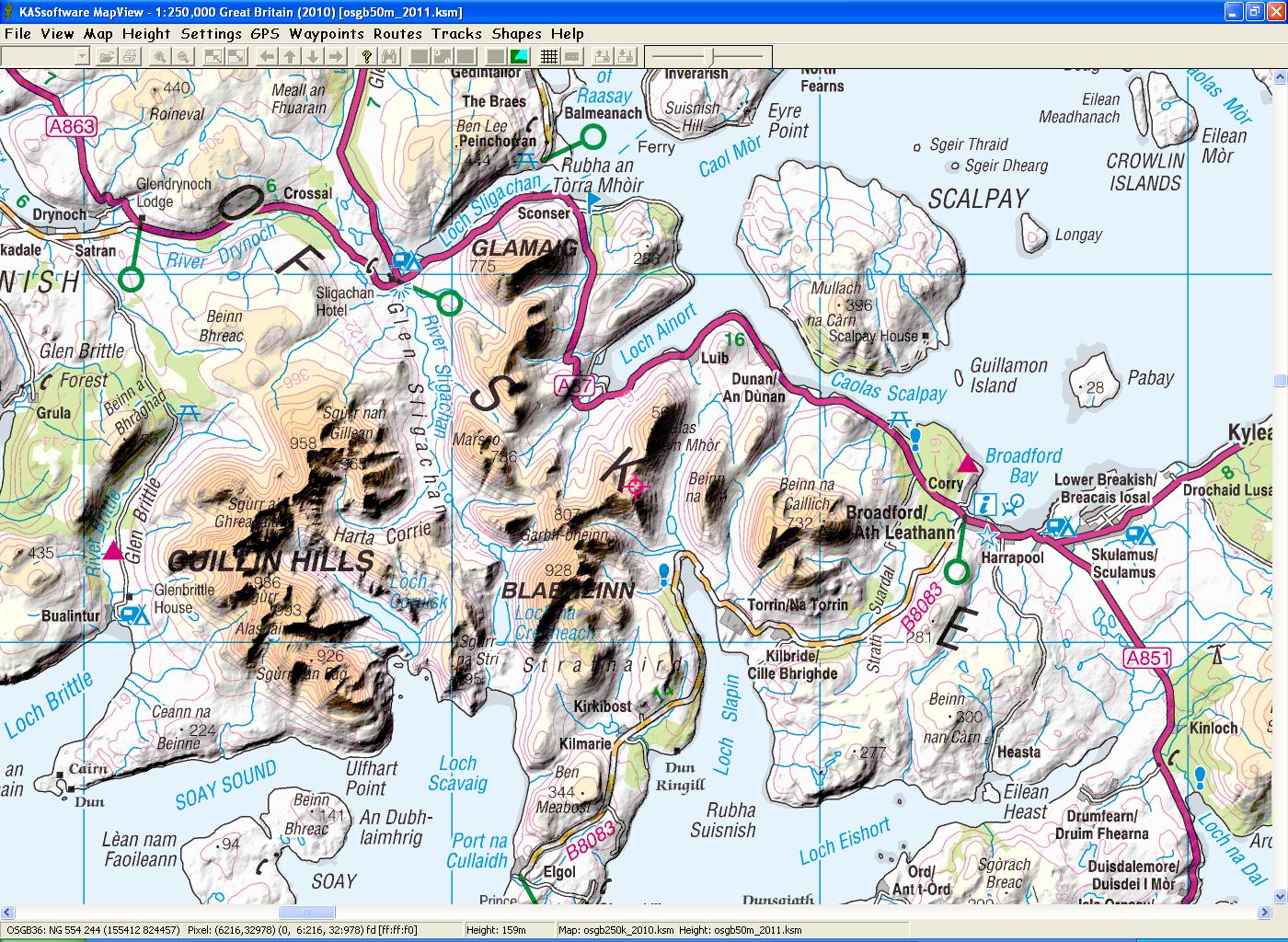
Gazetteers
Gazetteer information is presented in a dialog box which allows searching by name - or part thereof - and by feature type. Matches can be sorted alphabetically, by distance or by region/district location.
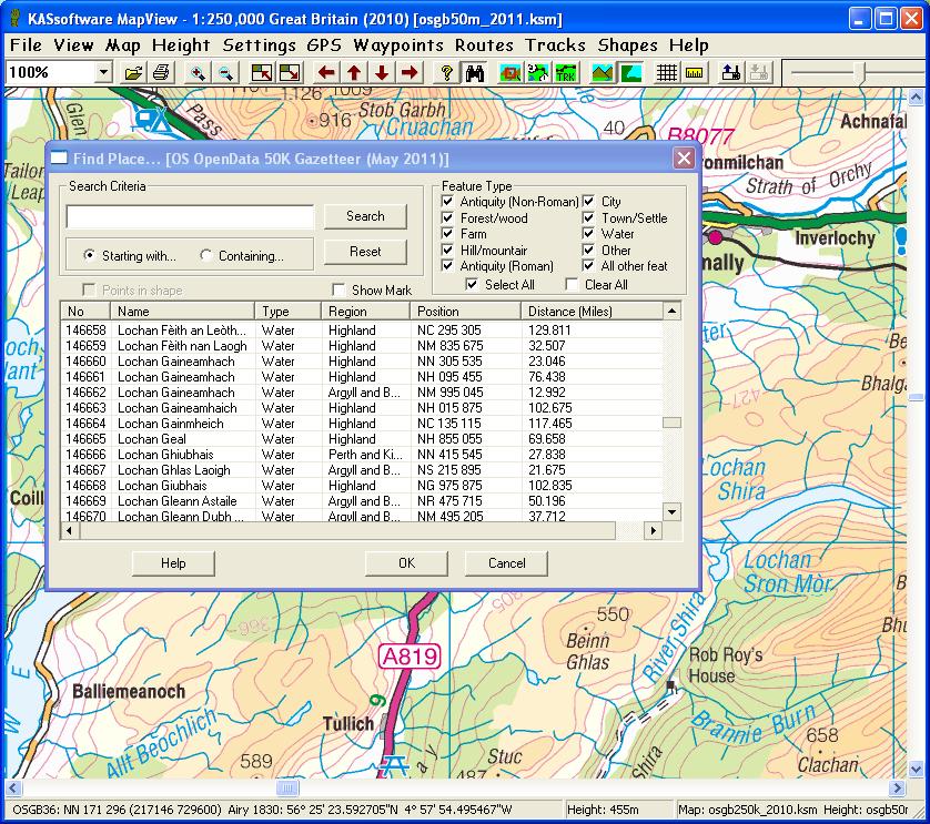
GPS Interfacing
mapView provides a comprehensive interface with a large range of Garmin® GPS receivers - including the etrex Summit, etrex VISTA C, foretrex 101, GPS 12, GPS 38 and the Edge 305 cycle computer - with many Magellan® GPS units - such as the 315 - and provides a rudimentary interface with other GPS devices that support the NMEA output protocol.
mapView Release History
2.2.0 25th July 2016 (mapView current release)
- New release to support KAS Software maps for sale
2.1.6 20th June 2016
- Urgent bug fixes to setup program to allow correct installation on Windows XP.
- New program included in installation for XP registry setting.
2.1.5 29th May 2016
- Improved viewing of Memory Map & Satmap maps (disabled by default).
- New right-click option to view specific map segment.
- Freeing of map data and logging of data usage improved.
2.1.4 10th August 2015
- Lod maps added (requires DirectX9).
- Further gazetteer mods.
2.1.3 10th Jan 2014
- Some gazetteer and 3-D view improvements.
2.1.2 14th May 2012
- Some improvement to height map 3-D viewing.
2.1.1 1st May 2012
- Added support for DEMs and for some differently formatted GeoTIFFs.
2.1.0 15th April 2012
- Updated the 'Map->Details...' menu option to give useful information on map geo-referencing - Map (px,py) <-> PCS (x,y) <-> WGS84 - and updated the map list dialog to show a subset of this information.
- mapView can now read unencrypted Satmap map files and Memory Map unencrypted .qct and .qed files. There's more information on this below.
2.0.5 20th March 2012
- Added (currently undocumented) options to the 3D configuration window to control light position and colour, and to allow for some future OpenGL display mods.
- Some gazetteer improvements.
2.0.4 16th March 2012
- Improved OpenGL config by allowing a broader range of graphics card performances to be catered for. Removed use of glLists.
- Added magnify window - which can also be used in 3D mode for showing current position.
2.0.3 8th March 2012
- Improved help files.
- Added support for gdf 1.1 map and height files with new block and block data origins, and WKT text output for CRS.
2.0.2 5th Mar 2012
- Added code for NAD27 <-> NAD83 NADCON conversion for Hawaii. Modified the criteria used for selecting CONUS files.
- Improved registry debugging options - strings DbgFile & DbgLevel (under Software\KASSoftware\mapView).
- Fixed incorrect entry of license keys.
- Improved geotiff georeferencing for cases where projection parameters individually specified (specifically for LCC2SP & Albers).
- Added .csv files and test map to release package.
2.0.1 24th Feb 2012
- Hill shading of elevation data maps corrected.
- Added index and directory fields to, and changed header widths for, the 'Load Map' and 'Load Height' panels, and improved column header sorts for both those panels. Added a new single button to each of these two panels to load in new height data (from the 'Load Map' panel), and to set a new map (from the 'Load Height' panel).
- Added an index field to the 'Load Gazetteer' panel, and made the column header clickable, though sorting therein has not been implemented.
- 'Load Map Layer' panel modified to list only those map segments which overlap with current map centre.
- Improved qct data extraction by removing terminal bug for byte0 case 0xfc.
mapview installation
The mapView program and associated getting-started files are packaged in a self-extracting zip file which takes the form of a windows executable - run this to start the installation.
mapview help
The program comes with a downloadable comprehensive help which should ensure trouble-free use. Further online help is available here.


